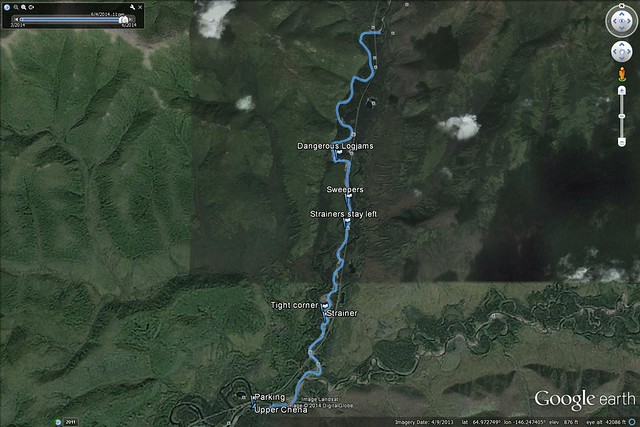
Click to open an interactive version of this map.
I paddled the lower half of the North Fork of the Chena River about a week ago, from the Angel Rocks trailhead to a gravel bar at mile 43. It's a nice class II, with one set of logjams (labeled 'dangerous logjams' on the map) that requires a class III+ move if you don't want to portage. I think I've convinced myself to bring my whitewater boat up from Arkansas.
The river got quite wide after joining the main fork just above my take out, and I suspect it's easy, fast cruising from there down.
Anyway, the map has tags for major obstacles, click to open the interactive version, and click the tags for brief descriptions. It should be useful for anyone planning to paddle this section and not sure what to expect. And the water seemed rather cold, dress for it. I was sick the next few days after spending too long wading and swimming trying to extract a friend and his boat from the 'dangerous logjams'.
No comments:
Post a Comment