Wednesday, October 10, 2012

Catching up: Summer photos

Salmon Glacier

Here's a quick collection of the best pictures I took on the road between Arkansas and Alaska.

Great Sand Dunes National Park in Colorado:

Great Sand Dunes National Park

Black Canyon National Park, also Colorado:

Sunset at Black Canyon

Alpine wildflowers at Great Basin National Park, Nevada:

Wildflowers

Moonrise, Lassen Volcanic National Park:

The Moon

Crater Lake National Park, Oregon:

Panorama: Crater Lake

I've tried to visit this lake multiple times in the past, and have been foiled every time (with one moderately successful visit in May under difficult light, see a few posts back), so I'm glad to finally get it right:

Panorama: Crater Lake

And here's a hugely large panorama I made which got a metric crapload of views when I posted it to Flickr (over 30,000 views the first day!). Apparently people really like being able to zoom in to individual trees several miles away...

Huge Panorama: Crater Lake

A hopping squirrel in the Hoh region of Olympic National Park, Washington:

Squirrel!

Diablo Lake at North Cascades National Park, Washington:

North Cascades

Horses in Marble Canyon, British Colombia:

Canadian horses

Salmon Glacier, in British Colombia, but you have to loop through Hyder, Alaska to get there:

Panorama: Salmon Glacier

I tried to visit here in May but the road was still too damaged from the winter:

Salmon Glacier

And finally, the Alaska Range over the Tanana River. Home!:

Panorama: Tanana River and Alaska Range

Thursday, September 27, 2012

Haven't been here in a while...

I last updated this blog in June... Well, since then, I've been on the road for around a month, then after returning to Fairbanks I kept myself away from here in an attempt to drive myself to study for my comprehensive exams out of sheer boredom if nothing else. The comps were at the end of August (I passed!), and so I have no excuse for not blogging in September other than the inertia of not blogging for July and August. Maybe now I can break that inertia and get back into a regular schedule. To start with, here are a couple of photography related updates:

Woodpecker tongue

This image of mine is going to be (may already be?) displayed in the Hall of Birds at Chicago's Field Museum. Very cool, this is a high class museum!

Denali Sunset from the south side

This one is being sold in poster format at a small business just outside the Denali National Park entrance. The place is already closed for the season, but springtime I'm going to have to stop by and get one.

(Side note: I should have done a 16x9 crop on that one...)

And I also got a couple of new cameras to play with:


This is my first ever film camera, a 4x5 view camera (Burke and James Speed Press), purchased with the license fee I got for the above posters. I've already shot about 20 pieces of black and white film, mostly at the Chatanika dredge and Denali, and I've learned to develop them. The negatives look awesome, but my scanner is crap so I can't digitize them just yet. Soon...


Also, a GoPro. My D5000 died this summer so I wanted a new daylight timelapse camera, plus this allows me to put it in 'dangerous' situations where it's likely to get wet, or dropped. I've already filmed a sequence of driving the Dalton Highway up past the Arctic Circle to Coldfoot, and another of driving the entire 92 mile Denali Park Road (a friend won the road lottery this year), I just have to process them and get them online.

Speaking of timelapses that are filmed but I need to put computer time into, I filmed the entire drive from Arkansas to Alaska... It took almost two weeks via backroads, and I have 25 minutes of video (45,000 pictures!). The whole drive, continuous... I'll have to edit it down to something manageable (maybe 5 minute length?), but it's coming.

Also, I've had two cameras in the windows of my cabin taking a picture every day at noon for a year now. One of these day's I'll put that together to watch a year pass by.

I have more to post, highlight pictures from the drive north, and some from around Alaska since I've been back, but I'll save that for another time.

Friday, June 22, 2012

In the desert

Panorama: Evening near Monument Valley

I mentioned last time we were going into Death Valley next. Somehow we managed to make it through Death Valley without taking a single picture between the three of us. It was bright and hot, take my word for it. We paid $20 to a small hotel just outside the park for use of their showers, and there was something... strange... about their water. It made you feel greasy. I've never got out of a shower feeling nastier than when I got in, so... that's a new experience.

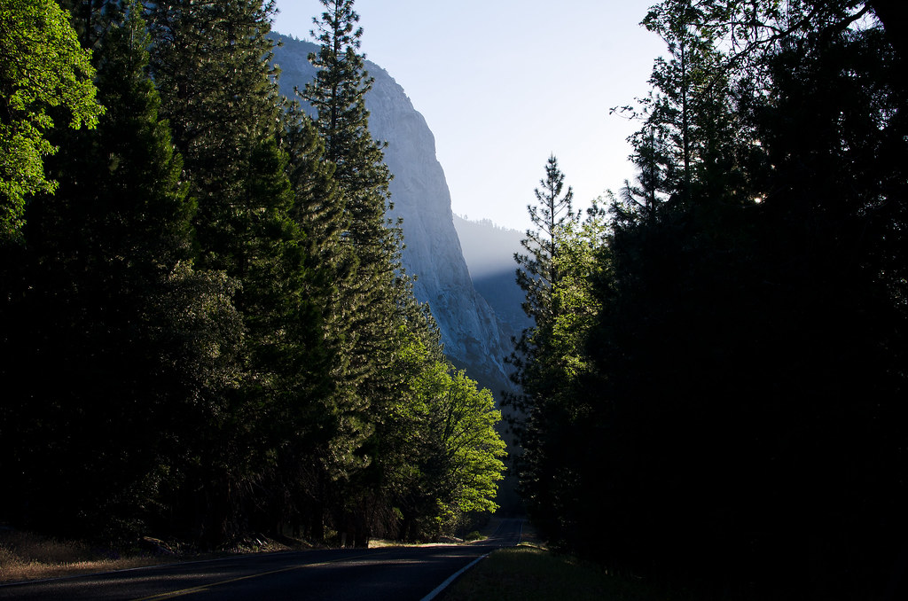
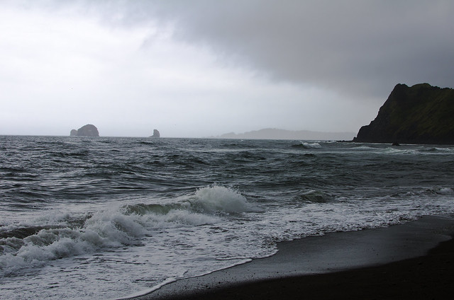
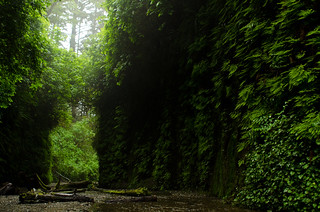
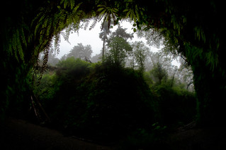
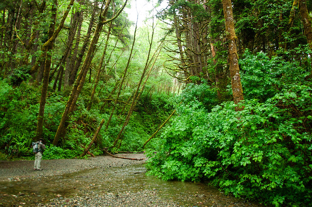
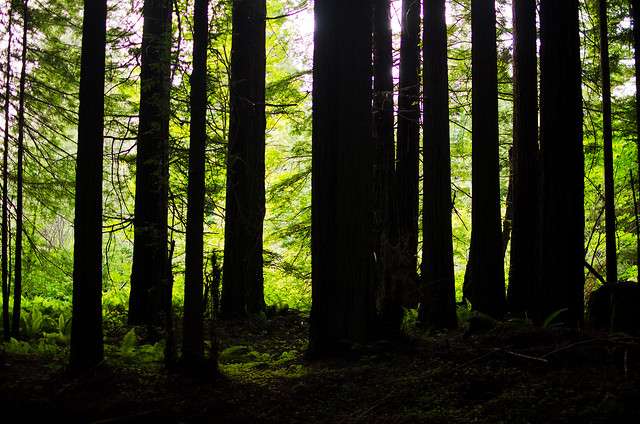
After skirting around Las Vegas we got to Zion National Park, which is one of the prettiest parks I've seen, but suffers from lots of tourists. We walked a little way up 'The Narrows', a slot canyon where you hike in the Virgin River itself:

The Narrows

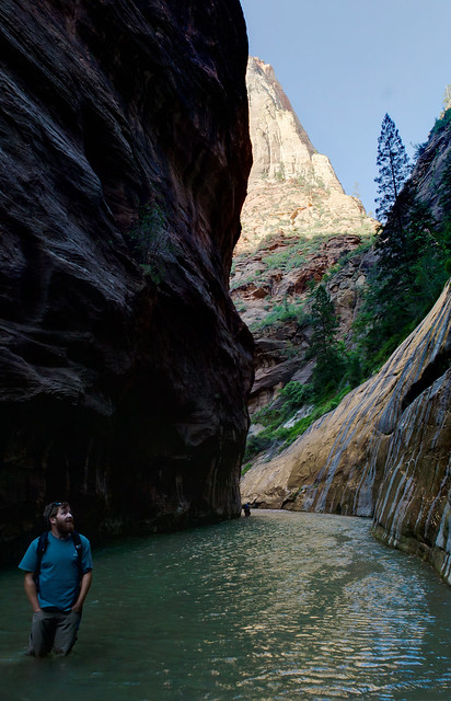
The shade and cool water is a perfect place to hike here on a summer day. I tried this same hike once in January and was quickly turned back by the near-freezing water.

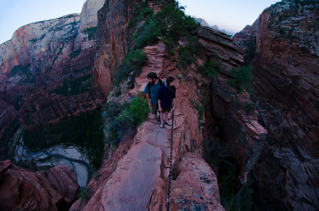
We didn't spend long here because I wanted to do the Angel's Landing hike. This is a very steep climb (around 1400 vertical feet) to a traverse across a narrow rock fin sticking out into the canyon. I've also done this one in January, when it's much sketchier since it's covered in snow and ice and you can't really tell where the edges are.

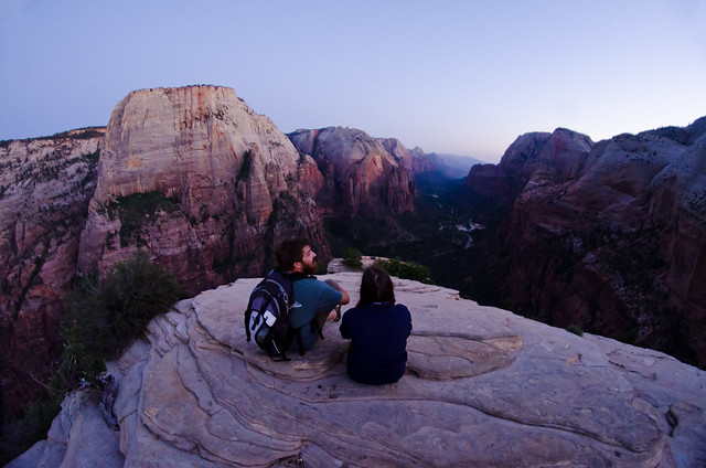
Stopping for a rest after the big climb:

Angel's Landing

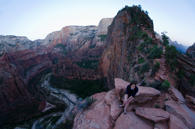
The narrowest point:

Narrow

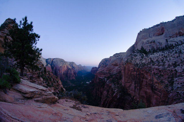
Near the end, looking down Zion Canyon:

Angel's Landing

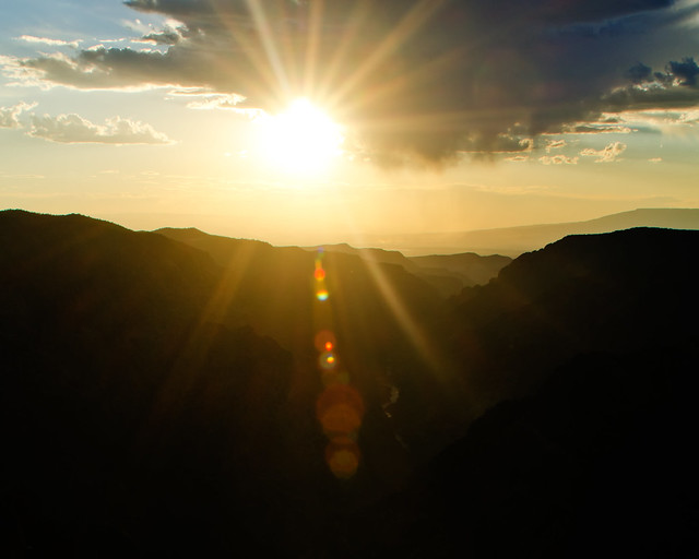
At Angel's Landing shortly after sunset:

Angel's Landing

We then had to get back down in the dark, with the one emergency headlamp I keep in my backpack between the three of us. I have pretty good night vision and I'm used to walking around in the dark, so I passed it off. The real worry here has to do with that 'Zion gets lots of tourists' thing. The road into the canyon is closed to private vehicles in the summer, so you have to take a shuttle bus - which stops running sometime in the evening. If we were to miss the last bus that would add another 10-15 miles of walking back to the car. So we hurried down the trail, and as we neared the trailhead we saw a shuttle bus coming. Is that the last bus of the night? We didn't know, so we acted as if it was, and Colby rqn ahead with the headlamp to try and beat the bus to the bus stop and talk the driver into waiting. He made it, and it was actually the last bus, so that was well timed. Would have been better timed if we were 15 minutes faster but it worked out.

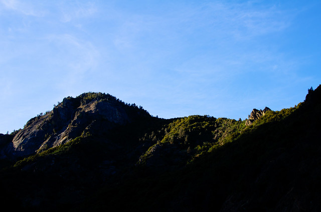
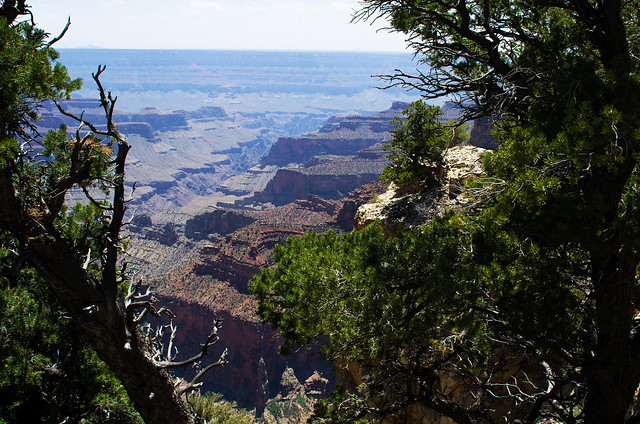
The next stop was the north rim of the Grand Canyon, because it was nearby and why not? Looking at Bright Angel Canyon running into the main canyon:

Bright Angel Canyon

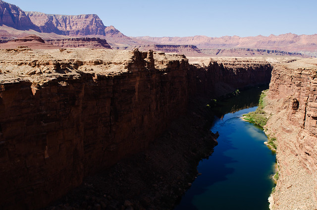
Then down an unknown but interesting looking highway, which passed through several neat small towns and over Marble Canyon:

Marble Canyon

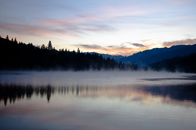
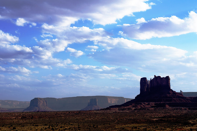
And evening just outside Monument Valley:

Utah Evening

We drove overnight and made it to Arkansas the next morning, where Iv'er been for the last 3-4 weeks. Tomorrow I head to Santa Fe for a week, then back north.

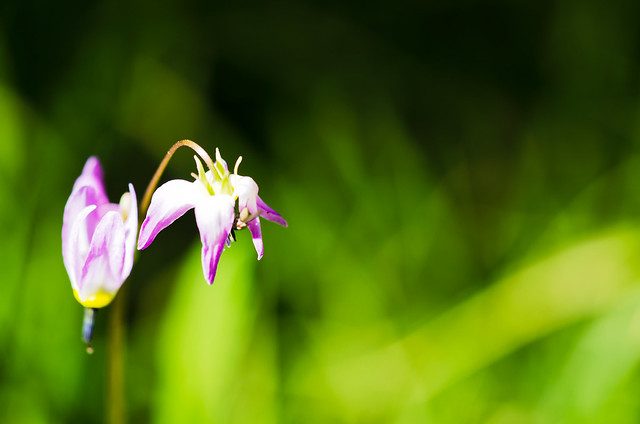
Oh, and happy (belated) summer solstice:


Wednesday, June 20, 2012

Over the mountain and through the woods

Kings Canyon Road

My last post shared the pictures from driving down the coast through Oregon and Northern California. Near San Francisco I turned east and headed inland towards King's Canyon and Sequoia National Parks. Pulled into the National Forest just outside the parks at dawn and saw a beautiful sunrise:

Dawn

Hume Lake

Then it was into King's Canyon proper. I've never been here and had no idea what to expect, but this park is awesome. Great scenery, appears to be fairly low-visitation, and has a large trail system into a secluded valley between high mountains. I definitely want to spend more time here. First direct light of the day was just reaching over the canyon walls when I got there:

First Light

Kings Canyon

Morning in Kings Canyon

Grizzly Falls

But we had places to go, so we only spent a few hours here before moving on into neighboring Sequoia National Park. Also a spectacular place, but it suffers from much more tourist visitation. The big draw here are the trees; some of the largest in the world. Note the group of people standing at the base for a sense of scale:

Just a group of people

Big tree Path

Dirt road Big Tree

Panorama: Big tree

We then found our way over to the east side of the mountain range. I really prefer to take back roads when I have the time, so I was on a small windy one-lane trying to get over the mountains, and we ended up lost for an hour or so. Which wasn't entirely bad because we were lost in a very pretty place. But finally we made it over and down into Death Valley.

Monday, June 11, 2012

West Coast

Beachcombers

Heading south on the Sea To Sky Highway dumped me out in Vancouver BC in late afternoon. I crossed into the US and camped in a stand of trees on the outskirts of the Seattle metro area. The next morning I passed through Seattle (I'm used to unpopulated Canada, get me out of here!) and down to Olympia to meet up with a couple of friends who live there. I was to pick up some more friends at SeaTac that night, but with the day to kill we went down to Mt St Helens for a little while:

Mt St Helens

After picking up friends and spending the night in Olympia, we all set off southward. Picked up the last member of our party in Roseburg OR, which made a group of 6 who all went to school together back at Arkansas Tech, then we headed to Crater Lake. I had hoped to make it in time for sunset, but it was an hour after dark when we got there and the light was really difficult. I gave it a try, anyways:

Crater Lake

We camped along the Rogue River near a nice gorge, which we checked out in the morning:

Rogue River

Then we used a closed backroad to head over a beautiful mountain pass and get out to the coast, where we planned to watch the solar eclipse, but our plans were foiled by heavy fog. We saw just the beginning of the eclipse before the fog blocked out the Sun completely. So instead we walked down to the beach and explored the tide pools.

Foggy hills Anemone

After a tasty dinner at a greasy seafood shack on the docks, we found a campsite in the woods next to the beach. The next morning we all walked down to the beach to explore more. Looking back up at the highway 101 bridge from the beach:

Highway 101 bridge

On the beach

Feather in the sand

The 3 of our party who lived in Oregon and Washington headed back north, and the rest of us continued south to Redwoods National Park. Though it was still overcast and drizzling, we stopped to hike at Fern Canyon, used as a filming location in Jurassic Park 2:

Fern Canyon Fern canyon alcove

My spare camera died here from being used in the wetness :( This was one of its last photos:

In Fern Canyon

Then it was on through the Avenue of the Giants through the big trees and away from the coast, finally turning back east:

Redwood forest