I've spent the last week staying with friends just outside of White Salmon WA, spending most of my time rafting and exploring the area, which has been pretty great.
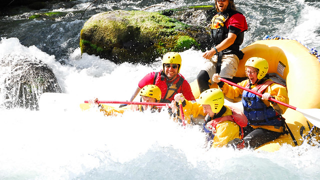
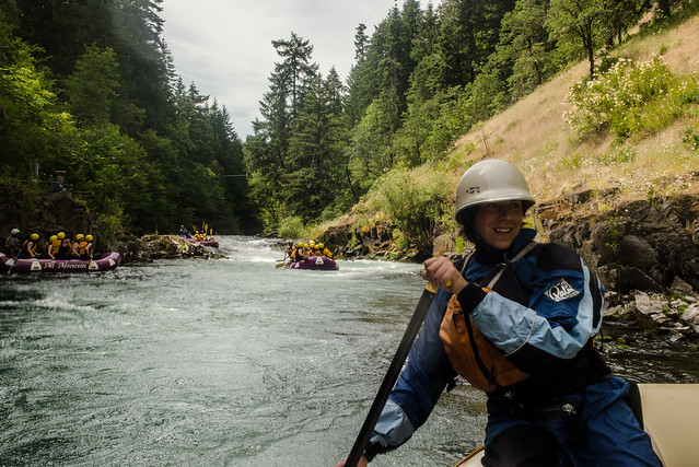
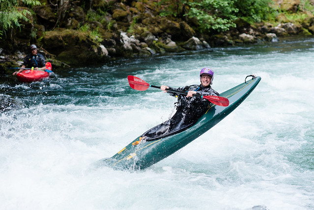
The most memorable part has been tagging along on whitewater rafting trips down the White Salmon River with my buddy's company All Adventures Rafting. If you're looking for some river fun in the area, you could certainly do worse. The White Salmon is an absolutely beautiful (and exciting!) river; the All Adventures guides are skilled, knowledgeable, and fun; and the owners just want to share their love of the river. Look them up. Here's me smiling at the camera as we plunge into the Rattlesnake wave while everyone else screams and holds on, taken by White Salmon Photography:
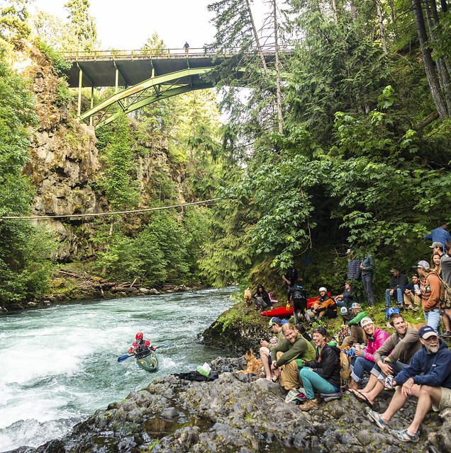
And a few shots from the spots on the river calm enough for me to get my camera out:
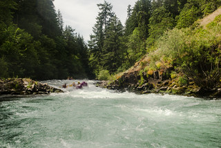
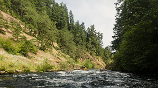
The White Salmon is a class 3+/4 river with a class 5 drop, Husum Falls. It's fed from the White Salmon Glacier on Mount Adams, which leaks down into the porous lava rock then pops out of the ground as many many springs. So, being glacier water that is underground for most of its journey, the river water is extraordinarily clean and cold, and you can pull off to the side and drink from the springs dribbling in from the edges. The rafts pass through three gorges made from collapsed underground lava tubes and volcanic mud deposits. Cedar waxwings, mergansers, ospreys, and bald eagles are common sights from the rafts, and the bottom end of the run is through 'new' river being carved out from the sediment left over after the Condit Dam was removed in 2011. Watch this video of the dam being breached and the reservoir draining; it's wild:
I rode along on raft trips my first three days here, and today I passed up on a trip and instead did some photography from shore. Here's one of the All Adventures boats going through Rattlesnake with a customer 'riding the bull' - sitting on the front tube with their legs dangling in the water:
If that embed doesn't work well for you, click here to see it. I'm having trouble getting the gfycat embed to work right.
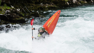
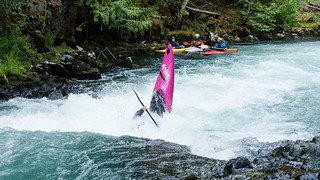
On the 19th I went to the Big Air Bonanza, which is a small competition put on in the little community of BZ Corner (where the put in for the White Salmon is). The organizer for the event is a former olympic whitewater kayaker, and I've been told he changes the date each year and gives little warning, so even though there are a bunch of people who'd like to compete, only a few end up being there at the right time each year. The audience waiting for a show:
The premise of the competition is that kayakers paddle upstream into a wave, which forces them underwater, then they do a trick when they pop back out. The audience judges them on whatever criteria they feel like and shout a score, and the scorekeeper just writes down whatever they hear as a common score. The paddler has two minutes, and they can win by doing lots of low-scoring tricks or a few high-scorers. The prizes? Some random household junk. It's all about having fun.
So I decided to try flying my drone above the trick spot and get some video. I got a little bit of the guy who won first place, then the breezes in the narrow canyon started making me nervous so I brought the drone back, clipping a tree limb (watch for chopped leaves!) then getting chased by a dog. It made for a neat video:
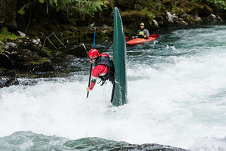
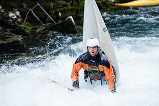
After that I was too nervous to try flying over the rapids again so I switched to my D610 and got some nice action shots of boats in weird positions:
I also spent some time driving up in the Mount Adams wilderness area, where there's an awesome system of backroads that are a lot of fun. One hot day my hosts and I were discussing what to do, and I suggested 'Are there any caves? Caves are cool in both senses of the word.' So they took me to the Guler Ice Cave, where we couldn't go too deep because we didn't realize we should dress warm for an ice cave, and we needed crampons/rope to descend down an ice slide. But the cave entrance was an excellent photography spot, and produced the photo at the top of this post. I also got out onto the 'roadless' area of the lava beds, following a network of jeep trails. Here's some not too interesting 3x video from driving around out there:
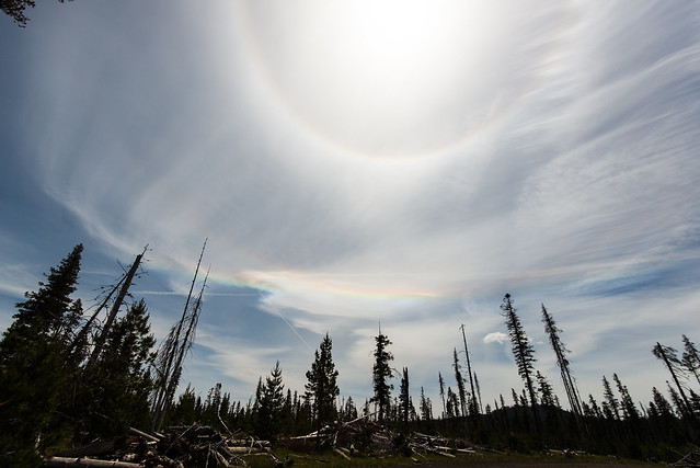
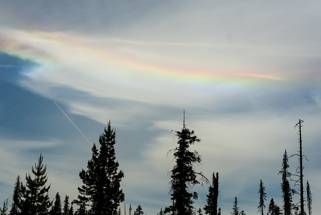
I also saw a circumhorizon arc, a.k.a. a 'fire rainbow', for the first time. They're not that rare from this latitude, but they're actually impossible to see as far north as Fairbanks.
I also enjoyed just hanging around the community and being in the 'river' frame of mind. 'Zen and the Art of Whitewater' would make an interesting book; something about working with the current rather than fighting it, looking forward to the next move rather than dwelling on the last one, and helping each other because you're all up the same creek. I like the mindset, and it pervades the river culture - sort of an active type of 'go with the flow' rather than the passive thing normally implied by that phrase. And I should mention the food - veggie breakfast burritos at North Shore Cafe in White Salmon, rotisserie chicken and live music (playing from the back of a truck) on solstice night at Big Mans in Husum, pulled pork nachos and local beer at Everybody's in White Salmon, and truffle pizza and more local beer at Double Mountain in Hood River. It's been a blast.
Tomorrow morning I fly for Norfolk VA then drive down to Duck NC, where I'll be helping with a rocket launch hopefully on the 28th. Then fly back to WA and start the drive down to AR. Until next time.