Two weeks ago I took a weekend trip up to Galbraith Lake, on the northern edge of the Brooks Range. This is a really beautiful spot with lots of mountains and endless open tundra. No trails, just pick a direction and walk. I drove up at a time when the last few miles of the Dalton Highway into Deadhorse were closed due to washouts, which meant no truck traffic. Trucks to the oil fields are like 95% of the traffic up here, so it was just hundreds of miles of empty road through empty arctic wilderness. Perfect. My friends and I left Fairbanks on Friday night and drove up to the Arctic Circle wayside to stay at the campsite, then went the rest of the way to Galbraith Lake on Saturday morning. Spent Saturday evening hiking in the hills to the west, then camped by the cars at the Galbraith Lake campsite before driving back to Fairbanks Sunday.
We did spot a moose with two calves in the middle of the road, about 4 miles north of the Yukon River. The calves were too slow or dumb to get out of the way and the cow was on the verge of charging my car to keep us away.
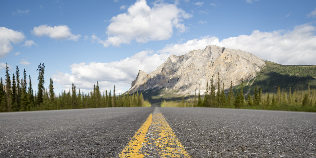
On the way north the next day we stopped at one of my favorite viewpoints, Sukakpak Mountain. It's a spectacular mountain, and I have this... spot where I've been trying to take shots of the mountain from the same spot with the same lens but in different conditions. So we stopped and I took some 'sunny, summery' photos:
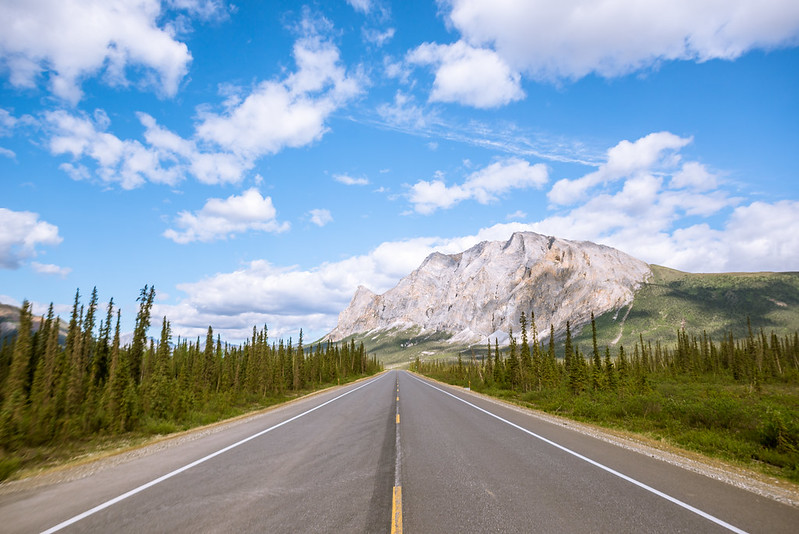
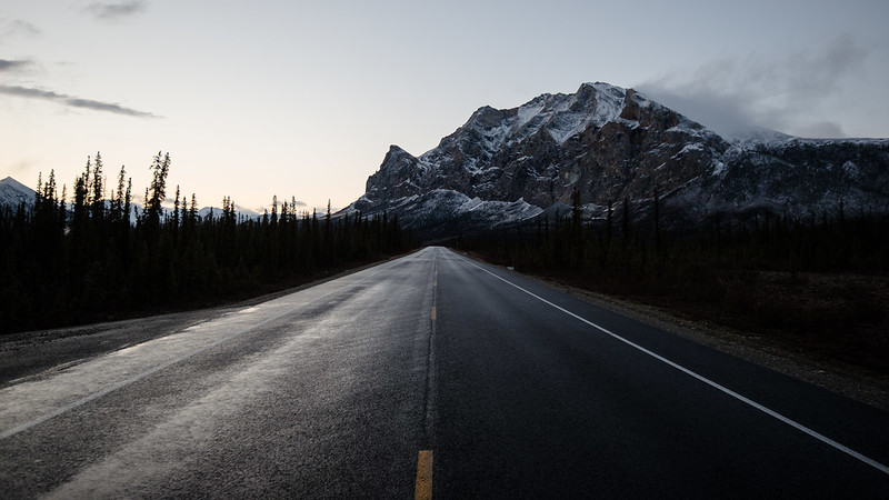
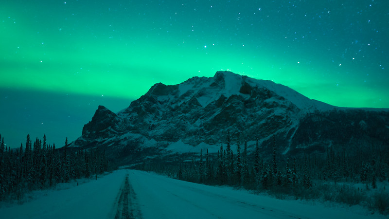
Some past shots with the same perspective and lens:
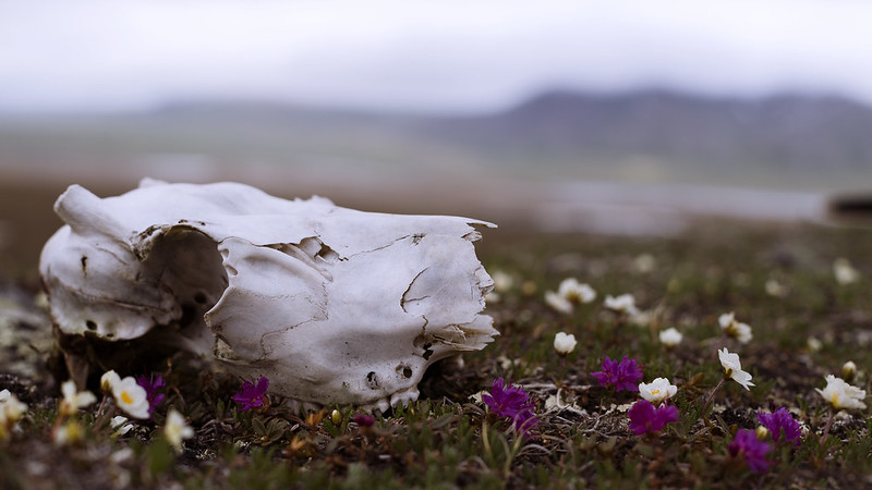
It was beautiful weather the whole way until we got over Atigun Pass into the Arctic Ocean drainage, where it was heavy overcast and windy. Most of the group went up the nearest highpoint but myself and one other stayed down in the pass and walked deeper into the mountains. Along the way I found quite a few old caribou bones:
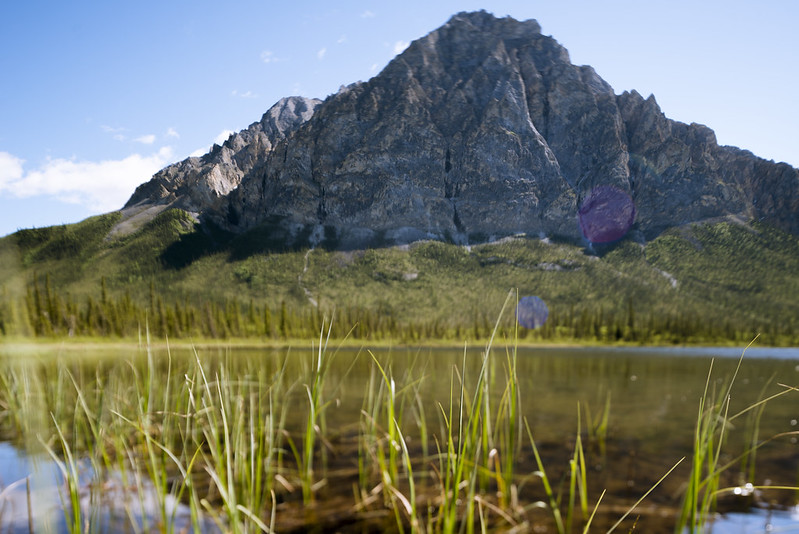
The overcast skies brought rapidly changing weather. People in the group who woke up at various times in the morning to step outside the tent and pee, and their reports indicate that in two hours time it went from calm and warm to horizontally blowing sleet you could hardly see through, and back to calm but cold. As soon as we were south of Atigun Pass it was a beautiful day again. We stopped again at Sukakpak, this time on the north side of the mountain. The mountain is less impressive from here but there is a nice lake and another mountain that isn't named on the USGS maps. We saw a moose and calf here but I didn't try to shoot it, instead playing with my wide angle tilt/shift to shoot the unnamed (?) mountain and lake:
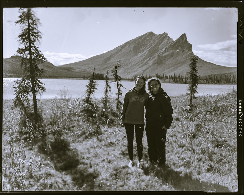
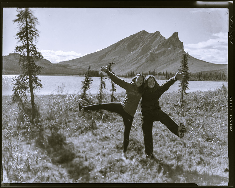
Also, I got my 4x5 view camera out and shot a few pieces of film. Here's the group (minus me) at the sign for the Arctic Circle wayside, posing as if they're an old wilderness road construction crew:

And here's a couple with the lake and the backside of Sukakpak Mountain:
The end of a great trip, and with the lack of truck traffic it was probably the best Dalton Highway driving experience one could hope for.