We took our first flight the other night, but the weather was uncooperative. The storm we went to fly was unproductive, and high cirrus clouds with us up at 45,000 feet were bright enough in the near-full moonlight that we couldn't even turn the image intensifiers on for a while. So we basically treated it as a shakedown flight and went through the motions, found a few kinks in the system, and spent the next night in the hangar ironing them out. We should be ready for business now.
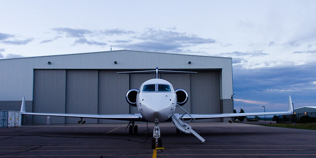
Our aircraft is NCAR's Gulfstream V, which is just a fantastic aircraft. I want one.

In the hangar.
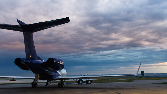
On the tarmac.
Inside, we have a bunch of electronics set up with seating positions for the five scientists plus an aircraft tech. And pilots, can't forget those. From front to rear, the science positions are:
1. Trigger man. This is the person who triggers the high speed camera when they see a sprite. It's a job for someone with good eyes and fast reactions, so it's where I'm sitting. I basically watch a monitor with my thumb on a trigger, and when I see a sprite in the Phantom field of view I hit the button which triggers both Phantoms to record, and yell 'Sprite!' into the headset/comms so everyone knows what just happened. At the speed we're running the Phantoms I have about 1 second in which to recognize a sprite in the field of view and hit the button. Then while the Phantoms are writing to permanent memory I record our position, heading, camera elevation/azimuth and settings into a logbook.
2 and 3. Camera operators. Their job is to physically point the cameras and to save the data after I trigger. Both of these positions have a Phantom high speed camera, running at 10,000-15,000 frames per second, on a mount facing out the window. The Phantoms have image intensifiers in front of them to be able to film low light events at such high speeds. These intensifiers are so sensitive they can be ruined by looking at the Moon, or even moonlight reflecting off a cloud, turning a ~$20,000 piece of equipment into a paperweight. In front of the intensifiers are standard Nikon F-mounts with fast 50mm Nikon lenses. The forward camera additionally has a diffraction grating in front of the lens so it can capture sprite spectra, the main focus of this campaign. There are also a few Watec 'context' cameras recording at 30 frames/second (err, 60 fields/second, but who's counting?) These context cameras have a wider field of view than the Phantoms and help us locate sprites and point the Phantoms in the right spot. One of the Watecs is what I watch on my monitor at the trigger station.
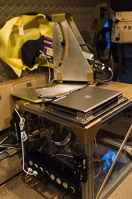
Forward camera position. The yellow cloth is to prevent light from inside the cabin reflecting off the window and into the lenses.
The mounts are really cool. On the campaign with NHK in 2011 we just strapped $10,000 television tripods against the wall, which sounds impressively expensive but doesn't work that well: The heads were unlevel so we had field rotation when moving the cameras in azimuth, and the axis of rotation was through the camera so the lens moved a lot when you panned, sometimes causing you to be looking at the side of the aircraft window rather than outside. These mounts are solid, level, and the rotation axis is right in front of the lenses so the lenses don't really move when you pan the camera. Awesome.
4. Sprite finder. This position has monitors displaying all the Watec cameras, and the job here is to pay attention to all of the monitors for sprites, then tell the camera operators where to point the cameras.

'Finder' seat on left, mission coordinator seat on right.
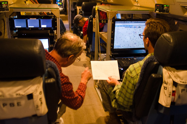
5. Mission coordinator. A computer on which the operator can call up all kinds of weather and lightning data in real time, plan where we should be flying, and inform the pilots.
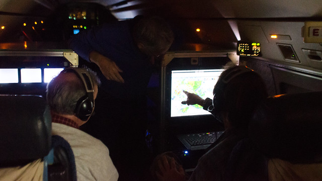
Hans, Geoff, and Ryan discussing the weather data in the middle of a flight.
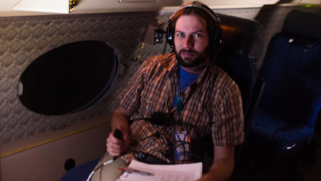
It occurs to me that the only position I don't have a picture of is
my position. I'll try to rectify that soon.