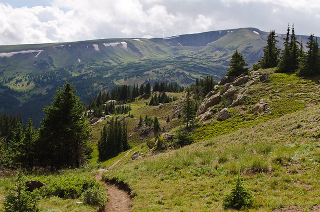
The website warned that the trail was poorly maintained and difficult to follow, but I actually found it pretty obvious and easy. I guess I'm just used to interior Alaska, where half the time there's no trail at all and you're just wandering about. From the parking area you climb up to a pass, then instead of descending the other side, you turn and start heading upwards. You come out of the trees pretty soon and it's all alpine meadows and scree slopes from there.
The parking area is around 11,000 feet. Both the Arkansas River Valley and the Tanana Valley are near sea level, so that's what I'm used to. Consequently, the altitude was kicking my butt on the uphills, so I took it nice and slow. Plus, I'm in no real hurry and have no particular destination, so why not take it easy? And the weather was great: ~70% could cover kept the direct sunlight off most of the time, and a stiff wind made it quite cool - enough to put a bite in the tips of my ears once or twice. Marvelous. It was amusing to be walking around in a thin t-shirt while everyone else had fleece jackets zipped up against the wind.
I have a tendency to not look at maps very closely before I go hiking. This is a double edged sword. On one hand, it reinforces the 'no particular destination' idea, and I spend more time wandering and enjoying where I'm at rather than focusing on where I'm going. On the other hand, it often ends up with me not really knowing exactly where I'm at. So it turns out I walked right past Mount Chapin and up the wrong mountain before I realized it. You wouldn't think accidentally walking past a mountain is something that's likely to happen, but there you go. I even surprise myself sometimes.
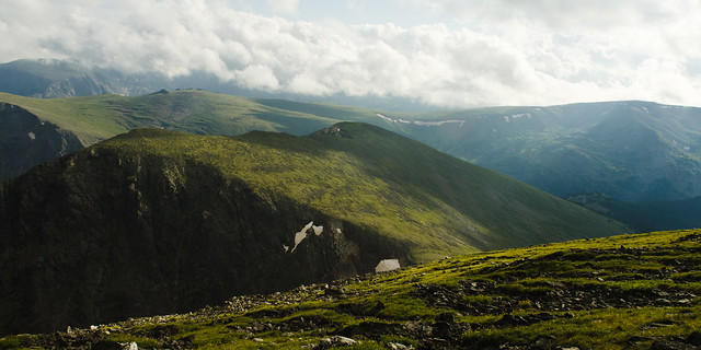
So, approaching the 12,500 13,000 foot summit of Mount Chapin Chiquita, I could see some low, grey overcast clouds on top. But I had been watching them for the last hour or so of approach, and the situation seemed to not be changing much; it looked like an orographic effect rather than a gathering storm. So I decided it was probably stable and safe to head on up. On top of Mount Chiquita I was just high enough to be in the bottom of the clouds, and it was rather chilly.
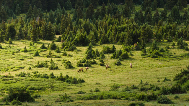
Heading back the way I came, I noticed a trail further down the mountain that looked much less rocky and side-slopey than the one I was on, and thus faster. With a strong suspicion that it went to the same place, I decided to descend the ~500 feet and try it. Right about the time I made the lower trail, I noticed a small herd of elk, perhaps 10 or 15 strong, in the valley below, with a single passing sunbeam about to illuminate them for a brief moment. I threw my bag down and barely dug out my 150mm lens in time to capture this, which ended up not really being that great anyways, but c'est la vie.
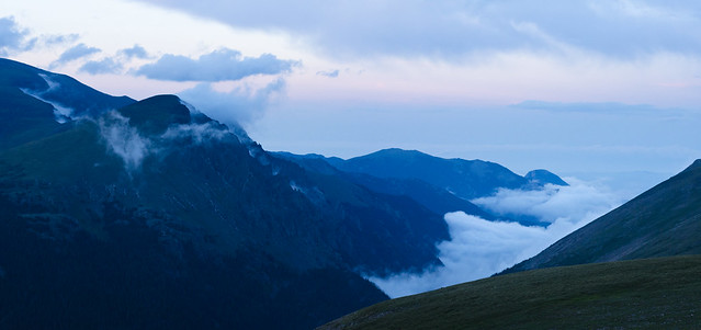
Back at the car, I noticed the main valley was filling with mist, so I stopped to grab the last picture of the night at the lava cliffs overlook.
No comments:
Post a Comment