Wednesday, May 14, 2014

Trip Report: Granite Tors


Click to open an interactive map in a new tab.

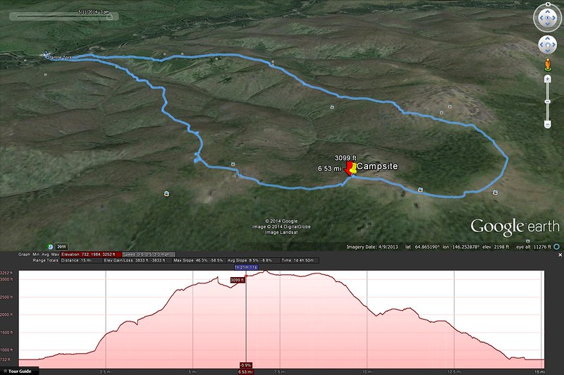
This weekend I went on an overnight hike to the Granite Tors, a group of large vertical rock outcroppings on top of a ridge above the Chena River. The trail is about 15.5 miles from the parking area, and it's slow going over most of the trail for various reasons - willows, elevation gain, rocks and tussocks at higher elevation. I put together a pretty slick interactive map so you can see the route and photos I took, but I can't figure out how to embed it on this page, so you'll just have to click through to get it.

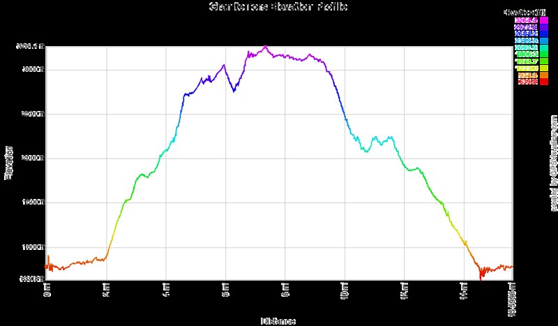
Here's the elevation profile color-coded to match the interactive map:

Granite Tors Elevation Profile

The trail starts off through some marsh land, and a crude boardwalk is set up to walk on:


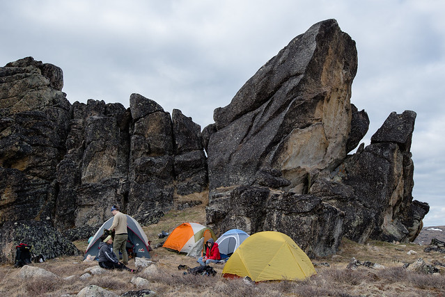
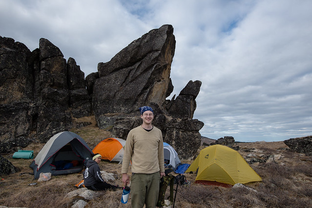
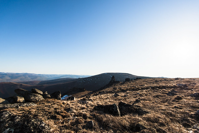
Climbing the ridge with a loaded pack is hard work, but very rewarding once you're on top. We picked a campsite under one of the tors (location pinned on the interactive map).

DSC_0972DSC_0973

DSC_0984DSC_1436

It was a great spot that had some shelter from the wind and even had water available right there in a few small tundra ponds, though it tasted like dirt. The evening light enticed me to take a few pictures before turning in to my tent to read a little then go to sleep:


When I stepped out of the tent at 6:00am, the morning light on the frosty tundra was beautiful, with a fantastic view of the Alaska Range over some more tors to the south:


Lee also wrote a blog post about it, click here to read.

There's a good chance I'll be back here at some point.

Thursday, April 10, 2014

Trip Report: Tolovana Hot Springs

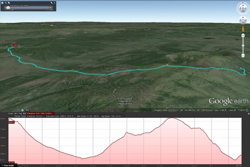
14May2014 edit: I made a slick interactive map that shows the GPS track and has pins for the photos taken along the way, click the image below to open it in a new tab:
ths
Click here to open an interactive map in a new tab.

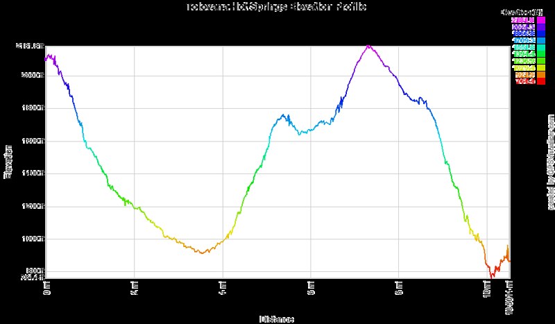
And here's an elevation profile color-coded to match the interactive map:
Tolovana Hot Springs elevation Profile

I made a trip out to Tolovana Hot Springs on March 30-31 with a few friends. It was my first time out there and my first time trekking while carrying my gear on a sled, and I thought I'd share a few pictures and thoughts.

First, the trail itself. It's 10.1 miles from the parking area at Elliot Highway mile 93. There are sign posts every mile on the trail so it's easy to keep track of progress. From the trailhead it's a drop of 1200ft into a valley, then across the valley itself which is fairly wide and flat, then over the top of Tolovana Dome; ~1300ft up then ~1100ft down the other side. It's really quite a large hill to drag a sled over; we seem to not have realized that, though the sled takes the weight off our backs, our legs still have to do the same amount of work in getting it up a hill. So we were cavalier and overloaded the sled, and I won't make that mistake again. I do think the sled was the way to go, just don't pack any more than you would carry on your back. The sled isn't 'look how much more we can carry now!', it's 'this stuff we were going to carry anyway won't stress our shoulders/backs all day'.

Route finding is super easy in winter since people ride snow machines out there every day. And snowshoes are unnecessary unless you want to go off trail. I wore a pair of YakTrax on my regular hiking boots and was quite happy with it. Summer may require more attention to stay on trail. I do intend to head out there again in summer so I'll find out. And if you're putting in the effort to hoof it out there rather than ride a snow machine, I recommend staying longer than one night.

I actually resurrected an old Magellan Triton 400 GPS unit I bought years ago that accepts custom maps so I could load the trail map and USGS topo maps of the area: I noticed that since the Triton only had 50MB of internal storage, I had expanded it with an SD card back in the day - 250MB. Big storage. It still works fine anyway, so I do actually have a detailed tracklog with elevation profile, and I should even be able to overlay that into Google Earth or Maps, but I can't seem to get the tracklog off the Triton through the SD card, and I have no idea where the weird proprietary USB cable is, so that'll have to wait until I get a new cable.

Parts of the trail have tons of ptarmigan/grouse tracks wandering around, especially the area in the valley. If you pass through in the morning you'd probably have a good chance of plugging a couple for dinner. We only saw one when we walked through in mid-afternoon, and it flew away while my shotgun was still on the sled.

We stayed in the Cedar Cabin, which was pretty nice. And for soaking there are 3 tubs set up alongside the hot springs creek the constantly get hot water cycled through them, and it's the best thing after a long hike. The lowermost tub has a pretty nice view to the south, and the middle tub is made of wood which grows lots of algae, so... I recommend the lower tub out of the two. We didn't try the upper tub.

I'm not sure what else I should say about it. Have some pictures:

The group (minus myself) near the top of Tolovana Dome, with Minto Flats off in the distance. Left-right Stephanie, Drew, Haley:


And facing back towards where we came from, with the car parked roughly where the ridgeline meets the sky just above Drew:


First moments after making it to the cabin and sitting down. Drew opens a bottle of gin, Haley puts together a hookah, Steph ties her hair back, and I take pictures. We all have our priorities :P


Then, everyone laid all their food on the table and we picked through it:


Cabin from the outside as we head down to the hot springs:


The middle tub:


Everyone out of focus in the lower tub. I'm a terrible photographer:
Wednesday, February 26, 2014

A UFO case study.

Last Thursday night we saw a UFO fly by at Poker Flat. Here's a clip of the all-sky video, you'll see it as a white cloud coming up from the west (left) horizon then disappearing.


Here's a 100% crop on the relevant part of the image:


It's definitely a cloud of some sort, you can watch it spread out and disperse. And if there was any doubt in your mind about that, here's a shot from a photographer on Pedro Dome (~10 miles south of Poker Flat) through a telephoto lens:


A wide angle shot from the same photographer, showing it's position in the sky:


And here's another shot from all the way over in Unalakleet, AK on the edge of the Bering Sea, ~650km west of here:


The one thing that jumps out to me instantly is they all have the object near the Andromeda Galaxy. Here's an annotated version of my cropped AASAP shot:


Okay, the Andromeda Galaxy in these photos is, um, maybe not all that obvious to most people even after it's been pointed out, but it's noticeable if you spend enough time looking at the sky and know the patterns. It's in all the photos except the telephoto shot.

Why is this relevant? Well, if even the camera 650km away is seeing it in roughly the same part of the sky, the object must be very far away. In orbit.

So I discussed this with a few rocket scientist colleagues and we decided the most likely answer is it's a fuel dump from a satellite or rocket. it's so high up that the dumped fuel is still in sunlight, that's why we can see it so well. And that's why it seems to follow such a constant path - no winds up there. We're just watching the cloud of fuel spread out and disperse.

Two days later, after the image was posted on Spaceweather.com, a satellite tracker wrote in about a Delta 4 rocket carrying a new GPS satellite which was in that exact location in the sky at that time. And, further, the rocket had just 12 minutes earlier separated a stage, which entails dumping excess fuel.

Consider that a UFO turned into an IFO.

Sunday, February 16, 2014

Auroral Forecasting: A Study Guide

There's two main things I look at when I'm trying to figure out what the aurora's about to do: Solar wind and Earth's magnetosphere. I guess that much is obvious since the whole show is caused by the interaction of those two things.

I'm sort of assuming you know the basic idea of how auroras work here: The Sun emits plasma which makes up the solar wind, when the solar wind collides with Earth's magnetosphere (if the solar wind is 'south' or 'negative') it strips magnetic field lines off the dayside of Earth and drapes them back behind the planet, where they 'reconnect' and accelerate plasma down the field lines to make aurorae. It still happens when the solar wind is north, BTW, just the geometry is different so where the plasma comes down to Earth is different.

So what you mostly care about is how much stuff is coming in on the solar wind, if the magnetic field geometry is right (southwards), and how much Earth's magnetosphere is being squished and stretched in response. I look at the readouts from two satellites to get this: ACE which sits about an hour upstream of Earth measuring the solar wind, and GOES-15 which is a geosynchronous satellite sitting at 135W longitude measuring (among other things) the shape of Earth's magnetosphere.

Here's a readout of the last two hours at ACE. I like this two hour display but everyone else seems to like the longer ones. Whatever. Either way, you look for the speed or density to be high (the amount of stuff coming in) and for Bz to be negative (which means the field is southward, and the more southward the better). Since ACE is about an hour upstream, whatever you see happening at ACE will reach Earth an hour later.

And here's the readout from GOES. This is measuring the component of Earth's magnetic field parallel to the dipole axis (at the location of the satellite... you'll see a daily up/down cycle which is the satellite going around the planet once a day). In simple terms, when the satellite is near midnight (marked 'M' on the plot), a high value means the field is not very compressed, and a low value means the field is compressed and storing magnetic energy. When that energy releases you see the value suddenly jump upwards, and that probably means some plasma has been accelerated down the field lines and you should expect to see the aurora brighten in roughly 10 or 15 minutes. The higher the jump up, the more energy released, and the more auroral activity you should expect. When the value drops below about 50 you should expect a release soon.

And oh, but they give it as a three day plot? How awkward is that when you're looking for features on the scale of minutes? So this 3 hour plot is better.

With that in mind, I put together something of a 'study guide' display. It's one thing to hear this stuff as theory, but it's much better to see it in practice. So I took the timelapse movie of the night's activity from AASAP and overlaid the last hour of ACE Bz data and the last 30 minutes of GOES Hp data. This is useful I think for anyone from a beginner to a seasoned vet because it lets you watch in a minute or two how these factors work together over a whole night. Here's the video from Feb 08, when we had a fairly short but quite spectacular display:


So if you watch, Bz was around zero or weakly south from the beginning, leading to some slow but steady buildup of magnetic energy in Earth's magnetosphere, reflected in the Hp number being down around 40nT. Around 06:00UT Bz turned more solidly south, and one hour later that led to a pretty strong buildup of magnetic energy as Hp went down to around 20nT. Bz jumped back sharply to the north around 07:00UT, and when that jump reached Earth an hour later it triggered the release of all that stored magnetic energy - GOES Hp jumped nearly 50nT in 10 minutes! That's a really large jump, and as expected 15 minutes later we see that westward traveling surge come in from the east (right) side of the image and the aurora gets very bright and active. Once the energy is used up the bright arcs fade away, leaving a large mass of drifting, pulsating diffuse aurora, which is pretty typical - this is the recovery phase of the substorm. Bz remains north for a few hours, and so isn't 'driving' the aurora very much and we just get some very weak diffuse stuff for a while, but around 12:00UT it turns south again. This late in the evening the GOES satellite is no longer well positioned, but an hour later we do see the aurora brighten up and get more active. This late in the evening Poker Flat is coming out of the 'auroral electrojet' where the brightest, most active displays happen, so instead of super bright arcs like earlier the display is dominated by large patches that drift around and pulsate. This continues for the remainder of the night as Bz remains southward.

So yeah. I'll be making more of these overlays when I get good example nights, and I hope people can learn by watching them. I chose this night as the debut because we had that really impressive 50nT jump in Hp. Here's what the GOES 3-day plot of that looked like:


And here's a 5 hour plot:


And, in case you were wondering what that looked like in person, here's a video from an intensified CCD video camera. It's black and white, and kind of noisy, but it can record the aurora in real time video, so that's something. I sped it up by about 4x to better see the dynamics of the westward traveling surge come in, and the arc movement. This should give a good idea as to how much it was actually moving around.


Sorry about the big black thing blocking part of the sky. The camera is sensitive enough that the Moon will ruin it, so that's the lawnmower battery we set next to the camera to block the moonlight. It's very high-tech.